

 DMZ
Ecology
DMZ
Ecology
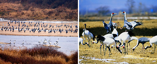
The DMZ is approximately 992 square kilometers in area and consists of mountains, plains, valleys, and basins. The area is home to many internationally protected species, endangered species, natural monuments, and protected wild flora and fauna. It also offers a habitat and migratory route for important waterfowls and crane species. Currently, of the 2,900 species inhabiting South and North Korea, 960 flora species, 35 of the 70 mammal species, and 64 of the bird species are found in the DMZ.
DMZ
Tour
Civilian access to the DMZ is strictly controlled. Certain areas restrict
individual tourists from visiting the area on their own, making some tourist
sites in the area available for sightseeing via a few DMZ tour packages offered
by select travel agencies. Also, a visit to the DMZ often requires an ID card,
passport, or other types of documentation for identity check purposes. 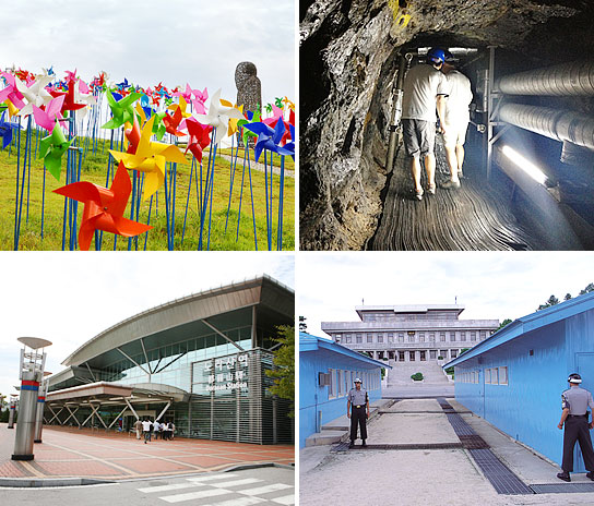
(From upper left in a clockwise direction: Nuri Peace Park at Imjingak, Third Infiltration Tunnel, Dorasan Station, and the Panmunjeom)
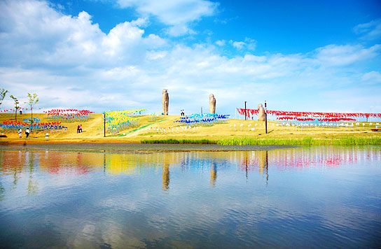
Imjingak (Nuri Peace Park)
Established in 1972 immediately after the declaration of the joint South-North statement, Imjingak exhibits various relics and monuments related to the Korean War and subsequent South-North confrontations. The Nuri Peace Park is a large park that can accommodate up to 20,000 tourists at a time. The park has a variety of sculpted artwork and visitors can enjoy performances on the hill.The 3rd Tunnel
First discovered in 1978, the tunnel was designed for a surprise attack on the Republic of Korea by the North. The tunnel is 1.7 kilometers long, 2 meters high and 2 meters wide. It is a prime example of the South-North confrontation. (ID card and passport are required.)Dorasan Station
Dorasan Station is the northernmost railway station situated on the Gyeongui Line. It is located 30 meters from the Southern Limit Line. From the station, visitors can view Dorasan Mountain and the barbed wire fences of the Southern Limit Line.Panmunjeom
Panmunjeom was established as a venue for dialogue between South and North Korea in accordance with the armistice agreement signed on July 27, 1953 after the Korean War. It is now known world-wide as the place where the military armistice conference was held (ID card and passport are required.).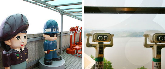
Unification Hill and Aegibong Peak Observatory
Unification Hill (Odusan Unification Observatory)
A place for education on security matters, Unification Hill is situated where the Hangang River joins the Imjingang River. It is also conveniently located near Heyri Art Valley.Aegibong Peak
Aegibong Peak in South Korea is a great place to view a wide expanse of North Korean land. The area is frequented by people who left North Korea during the Korean War and became settled in the South after the war (Closed on Mondays; ID card and passport are required).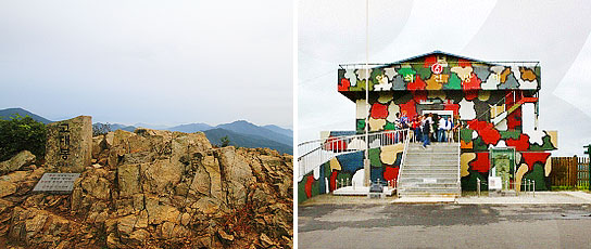
Godaesan Mountain, Yeolsoe Observatory
Godaesan Mountain
Godaesan Mountain stands to the right of Sintan-ri Station. It rises 832 meters above sea level. From the summit, one can get a view of the Cheorwon Plains and the Baekmagoji Highland Battlefield.Yeolsoe Observatory
The Yeolsoe Observatory is an observatory that offers a birds-eye-view of North Korea. On exhibit are daily household goods and military equipment from North Korea, allowing visitors to get an indirect experience of the North (ID card and passport are required.)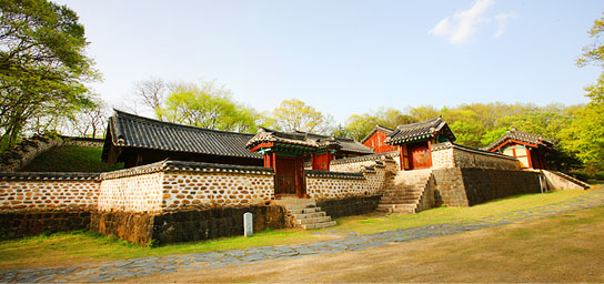
No comments:
Post a Comment